After tornadoes struck Detroit and Marysville and storms caused widespread damage, Metro Detroit residents can expect a return to mild weather for Labor Day weekend with lower humidity and temperatures near seasonal norms
Metro Detroit is finally set to catch its breath after a turbulent week of severe weather that included two confirmed tornadoes and widespread storm damage. The region, battered by high winds and heavy rain, now looks ahead to a stretch of calmer, more comfortable conditions just as the Labor Day weekend begins.
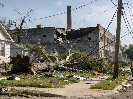
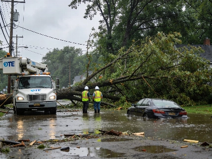
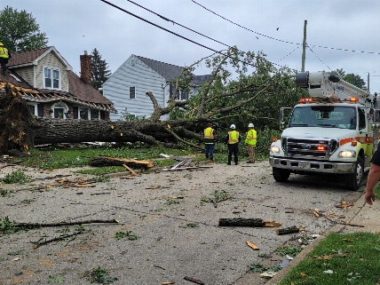
Thursday marked a rare event for Detroit, as a tornado touched down on the city's east side-the first confirmed tornado within Detroit in nearly three decades. The day before, Marysville also experienced a tornado, compounding the impact of back-to-back days of damaging storms across Southeast Michigan. Fallen trees, property damage, and localized flooding left many residents cleaning up as the week drew to a close.
Labor Day Weekend Forecast
While a few showers and isolated thunderstorms remain possible Friday night, especially in southern parts of the region, the risk of severe weather has dropped significantly. According to meteorological reports, rain chances will decrease overnight as the weather front responsible for the recent storms moves south toward the Michigan-Ohio border.
Saturday brings a noticeable shift. High pressure is expected to build over the Great Lakes, gradually clearing clouds from north to south. Daytime highs will reach the mid- to upper 70s, with Metro Detroit forecasted to top out around 79 degrees. Humidity levels will drop, offering a much more comfortable atmosphere for outdoor activities compared to the muggy, stormy days earlier in the week.
Events and Outdoor Plans
Sunday's outlook is even brighter, with abundant sunshine and dry conditions expected. Highs will remain in the upper 70s, aligning closely with typical early September temperatures. The timing is ideal for several major events scheduled across Metro Detroit and Southeast Michigan, including the Michigan State Fair in Novi, Detroit Jazz Festival, Arts, Beats & Eats in Royal Oak, and the Romeo Peach Festival.
Labor Day itself is projected to deliver some of the best weather of the weekend, with clear skies, light winds, and a high near 80 degrees. Boaters can expect generally favorable conditions, though winds from the northeast and east may be breezy at times on Saturday, particularly on Lake Huron. By Sunday and Monday, winds are expected to ease, and wave heights on Lake St. Clair should remain around one foot or less.
Looking Ahead to Next Week
After the holiday, temperatures are forecast to climb into the lower 80s on Tuesday, with a more pronounced warm-up by Wednesday. Highs could reach the mid-80s and persist through the latter half of the week. The next organized chance for rain is expected Wednesday as another cold front approaches the Great Lakes, though the timing and extent of precipitation remain uncertain at this stage.
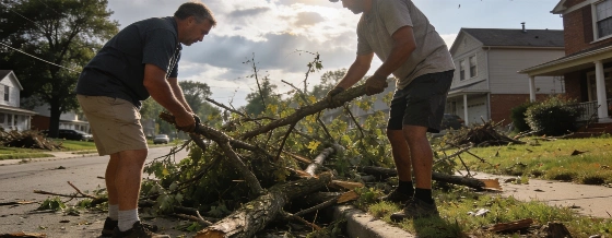
For residents still dealing with storm cleanup, the stretch of dry, mild weather offers a window to address damage and restore normal routines. The recent tornadoes and storms serve as a reminder of the region's vulnerability to severe weather, but the forecast now gives Metro Detroiters a much-needed reprieve. As the community turns its attention to festivals, outdoor gatherings, and late-summer activities, the return of stable weather is more than just a relief-it's a chance to reclaim the season after a week of disruption.
For those interested in sharing photos of the recent storms or the improving conditions, submissions can be made through the MIPics platform at MIPics.
Michigan's weather can turn quickly, but this weekend's forecast rewards residents with a break from the chaos. After a week defined by tornadoes and storm recovery, the region's ability to rebound and make the most of the holiday weekend stands out as a testament to local resilience and the value of timely, accurate weather information.