
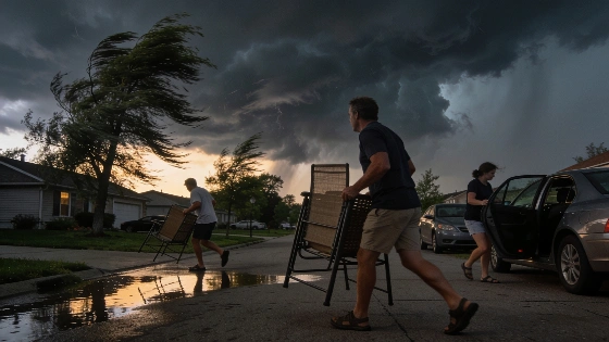
Oakland and Livingston counties face severe thunderstorm warnings until 11:45 p.m. Wednesday, while most other Metro Detroit counties remain under no active alerts. Residents are urged to monitor conditions as storms move through the region.
Severe weather is once again testing Southeast Michigan's readiness, as the National Weather Service placed Oakland and Livingston counties under a severe thunderstorm warning until 11:45 p.m. Wednesday. While most of Metro Detroit remains outside the warning zone, the targeted alerts signal a heightened risk for damaging winds, heavy rain, and lightning in these two counties.
For residents in Oakland and Livingston, the warning means immediate attention to changing conditions is warranted. The rest of the region-including Wayne, Macomb, Washtenaw, Monroe, Lenawee, Lapeer, Genesee, St. Clair, and Sanilac counties-currently faces no active weather alerts, according to the latest updates. However, the unpredictability of summer storms means all communities should remain alert as the system moves eastward.
Counties Under Warning
Oakland County and Livingston County are the only areas in Southeast Michigan currently under a severe thunderstorm warning, effective until 11:45 p.m. Wednesday. The warning covers a population of more than 2 million people, including major suburbs and rural communities. The National Weather Service advises residents to seek shelter indoors, avoid unnecessary travel, and monitor local weather updates for further instructions.
Wayne County, which includes Detroit, along with Macomb, Washtenaw, Monroe, Lenawee, Lapeer, Genesee, St. Clair, and Sanilac counties, have no active alerts as of Wednesday evening. This selective warning approach reflects the storm's projected path and intensity, focusing resources and public attention where the risk is highest.
Storm Tracking and Resident Guidance
Thunderstorms began moving across Metro Detroit on Wednesday, September 2, bringing a mix of heat, humidity, and unstable atmospheric conditions. The National Weather Service's radar continues to track the storm's movement, with real-time updates available for residents who want to monitor the situation closely. For those in the warning areas, the advice is clear: stay indoors, secure outdoor items, and be prepared for sudden changes in weather, including possible power outages or flash flooding.
Local governments and emergency management agencies have emphasized the importance of timely alerts and targeted warnings. As highlighted in reported earlier, municipalities across Michigan are increasingly relying on data-driven strategies to anticipate and respond to severe weather, aiming to minimize disruption and protect public safety.
How Alerts Are Managed
Severe thunderstorm warnings are issued when meteorologists detect conditions likely to produce damaging winds, large hail, or intense rainfall. The National Weather Service uses radar, ground reports, and atmospheric modeling to determine which areas are at greatest risk. Warnings are typically short-term, lasting from 30 minutes to a few hours, and are updated as the storm evolves.
Residents can access up-to-the-minute radar images and forecast details through local news outlets and official weather channels. The targeted nature of these warnings helps prevent unnecessary alarm while ensuring those in harm's way receive timely, actionable information.
As the evening progresses, the focus remains on Oakland and Livingston counties, where the severe thunderstorm warning is in effect until 11:45 p.m. The rest of Southeast Michigan should remain vigilant, as weather patterns can shift rapidly. The selective issuance of warnings demonstrates a more precise approach to public safety, but it also places responsibility on residents to stay informed and prepared. In a region where severe weather is a recurring challenge, the ability to respond quickly and effectively is not just a matter of convenience-it's a necessity.