
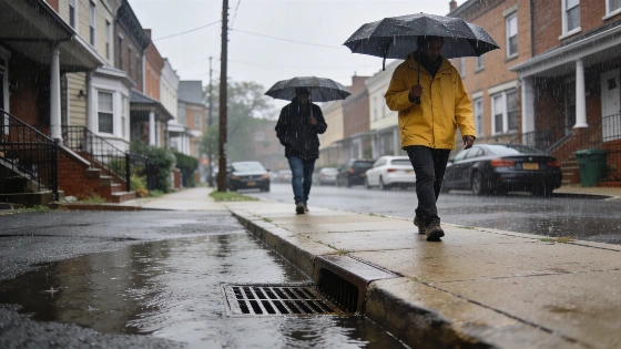
The National Weather Service warns that a storm system could bring intense rainfall and possible flash flooding to the Philadelphia region Sunday afternoon and evening, with severe storms also possible and rainfall rates reaching up to 3 inches per hour.
Residents in the Philadelphia region are being advised to prepare for potentially hazardous weather on Sunday, as a strong storm system is forecast to bring heavy rainfall and the risk of flash flooding. According to the National Weather Service, the main threat will occur Sunday afternoon into the evening, with rainfall rates possibly reaching 2 to 3 inches per hour in some areas.
While Saturday is expected to remain mostly dry and pleasant, the weather will shift significantly by Sunday, with showers and thunderstorms likely to impact the area. The National Weather Service has highlighted the possibility of isolated severe storms in addition to the flash flooding risk.
Storm Timing and Rainfall Details
The heaviest rain is expected to begin after 2 p.m. Sunday and continue into the evening hours. Forecasts indicate a 70% chance of precipitation during the day, with new rainfall amounts between a tenth and a quarter of an inch, though much higher totals are possible in thunderstorms. Sunday night, showers and thunderstorms may persist until around 2 a.m., with an 80% chance of precipitation and additional rainfall amounts between a half and three quarters of an inch possible.
Saturday will offer a break from the wet weather, with sunny skies and a high near 89 degrees. Overnight, temperatures will drop to around 70 degrees with partly cloudy conditions. On Monday, the forecast calls for a return to mostly sunny skies, though a chance of showers and thunderstorms remains, especially after 8 a.m.
Flash Flooding and Severe Weather Concerns
The primary concern with this storm system is the potential for flash flooding, particularly in low-lying or poorly drained areas. The National Weather Service urges residents to monitor local forecasts and be prepared for rapidly changing conditions. Severe storms could also bring strong winds and localized hazards, though the main threat remains heavy rainfall.
Residents are encouraged to avoid driving through flooded roadways and to have a plan in place should flash flooding occur. Emergency management officials recommend staying informed through local news and weather alerts throughout the weekend.
What Residents Should Know
Philadelphia-area communities should expect a dry and warm Saturday, but conditions will deteriorate Sunday afternoon as the storm system moves in. Those with outdoor plans on Sunday are advised to monitor the weather closely and consider adjusting activities to avoid the period of heaviest rainfall. The National Weather Service will continue to update forecasts as the situation develops.
Flash flooding can develop quickly, especially during periods of intense rainfall. Residents should be aware of flood-prone locations in their neighborhoods and take precautions as needed. Local officials may issue additional advisories or warnings if conditions worsen.
The National Weather Service provides regular updates and safety information for severe weather events. Residents can sign up for local alerts or follow official channels to stay informed about changing conditions and recommended actions.